
PeakVisor – 3D Maps & Peaks ID Mod
-
4

- 214 Votes
- 2.8.57 Version
- 95.40M Size
About
Recommend
Discover
Introduction
Step into the shoes of an outdoor adventurer and let PeakVisor – 3D Maps & Peaks ID Mod be your guide. This extraordinary app is the ultimate companion for navigating the great outdoors, offering state-of-the-art 3D maps and mountain identification right at your fingertips. With a simple snap of your phone's camera, the app works its magic, instantly recognizing any mountain peak that comes into view. Explore over a million hills and mountains worldwide, uncovering detailed profiles that include altitude, topographic prominence, mountain range, and even information about national parks and reserves. Immerse yourself in the landscape with cutting-edge terrain modeling, allowing you to effortlessly examine trails, summits, passes, viewpoints, and parking areas. Plan your next hiking adventure like a pro using PeakVisor's vast network of worldwide hiking trails, complete with elevation profiles and estimated completion times.
Features of PeakVisor – 3D Maps & Peaks ID Mod:
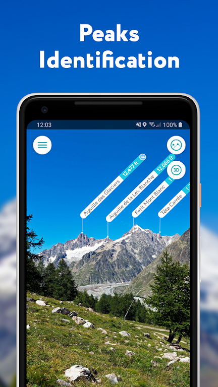
- Mountains Identification: The app uses augmented reality technology to instantly recognize and identify over a million hills and mountains worldwide. It provides detailed profiles for each peak, including altitude, topographic prominence, mountain range, and information on national parks or reserves it may belong to.
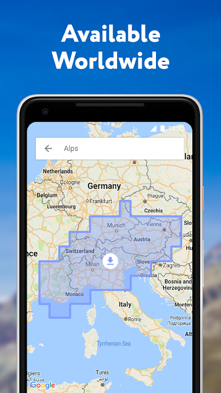
- 3D Maps: The app offers cutting-edge technology with high-precision terrain modeling, allowing users to explore mountainous areas with ease. Users can access detailed topographic maps that provide insight into the landscape, including trails, summits, passes, viewpoints, and even parking areas.
- Hiking Route Planner: With a vast network of worldwide hiking trails and walking pathways, PeakVisor's 3D Maps feature helps users plan their hiking routes. Users can evaluate the distance, elevation profile, and estimated time for completion of their desired route. Points of interest such as mountain huts, parking lots, cable cars, viewpoints, and castles are also included to enhance the planning experience.
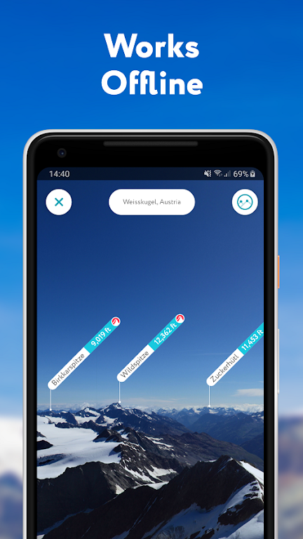
- Offline Access: PeakVisor does not require an internet connection to function. Users can download all the necessary data and use the app offline, regardless of their location or altitude. This makes it an essential tool for outdoor enthusiasts who may venture into remote areas with limited connectivity.
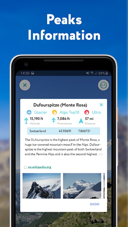
- Detailed Information: The app provides users with comprehensive information about each mountain, including photos and Wikipedia articles. This allows users to learn more about the mountains they encounter, enhancing their overall outdoor experience.
- User-Friendly Interface: The app offers a user-friendly interface that is easy to navigate. The app's intuitive design ensures that users can quickly access the desired features and optimize their outdoor navigation experience.
Conclusion:
PeakVisor – 3D Maps & Peaks ID Mod is a must-have app for outdoor enthusiasts. With its impressive mountains identification feature, cutting-edge 3D maps, and offline access, it offers a comprehensive solution for outdoor navigation. The detailed information provided, along with the user-friendly interface, makes it a valuable tool for exploring and planning hiking routes. Download now and become a superhero of outdoors navigation!
Similar Apps


You May Also Like


Latest Apps
-
 Download
마이달링
Communication / 42.70MB
-
 Download
Aarong
Shopping / 9.10MB
-
 Download
MarliangComic
News & Magazines / 3.40MB
-
 Download
Hide Pictures & Videos - FotoX
Tools / 34.49MB
-
 Download
Slovakia Dating
Communication / 12.90MB
-
 Download
Aman Car
Travel / 8.18MB
-
 Download
DOTDOT
Personalization / 11.00MB
-
 Download
AuctionTime
Finance / 15.60MB
-
 Download
ShareMe
Others / 35.20MB
-
 Download
Mstyle
Lifestyle / 30.30MB
Comments