
Geodir Maps
-
4.4
- 306 Votes
- 3.0.4 Version
- 7.00M Size
About
Recommend
Discover
Introduction
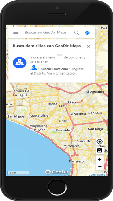
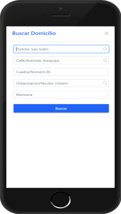
Geodir Maps revolutionizes the way field personnel operate by introducing efficient tracking and optimized routing. No longer will field workers struggle to find their way or waste precious time on unnecessary detours. With the app, everything is streamlined and made more productive. This comprehensive app leverages mobile technology to automate various field operations, resulting in improved time management and work processes. It also enhances productivity indicators, facilitates data capture, and significantly reduces response time. Additionally, the app offers an unrivaled planning and tracking experience using geolocation, ensuring that field personnel are always on the right path.
Features of Geodir Maps:
Time and Work Process Optimization: The app offers optimized routing and tracking features that help field personnel save time and streamline work processes. With the app, users can easily plan their routes and find the most efficient way to reach their destinations, resulting in increased productivity.
Increased Productivity Indicators: By using the app, businesses can improve their productivity indicators, such as the number of tasks completed per day or the amount of time saved through efficient routing. This not only helps organizations meet their targets but also enhances their overall performance.
Data Capture and Decreased Response Time: The app allows for efficient data capture through mobile devices, eliminating the need for manual data entry. This speeds up the process and significantly reduces response times, enabling field personnel to deliver quicker and more accurate results.
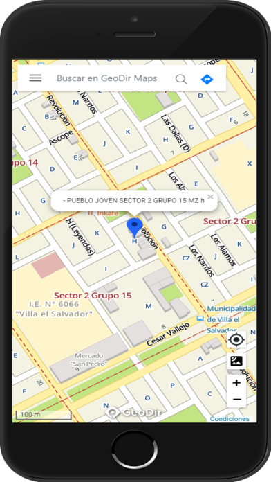
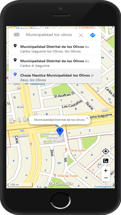
Route Planning and Tracking by Geolocation: The app utilizes geolocation technology to enable users to plan and track their routes with precision. Field personnel can visualize their exact locations on the map, ensuring they stay on track and reach destinations on time. This feature enhances efficiency and enables effective coordination between team members.
FAQs:
Can the app be used offline?
Yes, the app supports offline usage. Users can download maps and routing information in advance to access them even when there is no internet connection available. This ensures uninterrupted operations even in remote areas or areas with weak network coverage.
Is the app compatible with all mobile devices?
The app is compatible with both Android and iOS devices. Whether you have a smartphone or tablet, you can easily download and use the app to optimize your field operations.
Can the app be integrated with other software systems?
Yes, the app can be integrated with other software systems through API integration. This allows for seamless data exchange between different platforms, enabling businesses to synchronize information and streamline their workflows.
Conclusion:
Geodir Maps is the go-to application for field personnel looking to enhance their productivity and streamline their work processes. With features like optimized routing, geolocation tracking, and efficient data capture, the app enables users to save time, increase productivity indicators, and deliver quicker results. Additionally, offline usage and compatibility with multiple mobile devices make it a versatile solution for field operations. By utilizing the app, businesses can optimize their time, improve response times, and achieve their targets efficiently.
Similar Apps
You May Also Like
Latest Apps
-
 Download
Voice Recorder
Tools / 7.02MB
-
 Download
Facebook
Communication / 128.76MB
-
 Download
MX Player
Media & Video / 57.04MB
-
 Download
タイムズカー
Lifestyle / 7.90MB
-
 Download
HappyEasyGo
Travel / 25.40MB
-
 Download
iScreen - Widgets & Themes
Tools / 152.00MB
-
 Download
Mi Sentinel
Finance / 40.94MB
-
 Download
Tangerang LIVE
Others / 19.80MB
-
 Download
Surat Municipal Corporation
Lifestyle / 10.90MB
-
 Download
Google Maps Go
Tools / 1.00MB











Comments